Geospatial, Topographical and Measured Surveys
Geospatial, Topographical and Measured Surveys
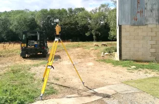
We have relied upon a Total Station for many years to provide us with mm accurate measured surveys of both land and buildings. This has proved invaluable in terms of the design service we can offer by ensuring that we have reliable and precise existing drawings of the site levels and the surrounding topography, and especially existing buildings upon which we are working.
This older technology has since been upgraded to a Topcon Total Station with a satellite GPS positioning receiver. This allows our team to know exactly where they are in the country to an accuracy of a few millimeters. The equipment is operated by one person allowing us the opportunity to better use our time when on site undertaking surveys, although measured surveys are often carried out by two of the team, where one operates the Topcon and the other undertakes internal building measures using Disto Lazer measurement.
How it works
The Topcon instrument uses a Windows 10 site computer with specialised software that allows us to also set out points on site quickly and accurately. We can take a CAD drawing, upload this to the site computer and then plot lines, points, and curves with ease.
In addition to using the equipment to measure all our own design projects, we also offer the following services to both individual clients and other professionals such as architects, garden designers, and solicitors:
- Measured surveys of land
- Measured surveys of existing buildings including internal floor plans
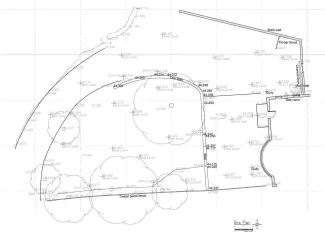
- Boundaries, both existing and setting out.
- Production of Plans for Land Registry purposes and disputes
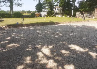
Setting out pile locations for a new build house
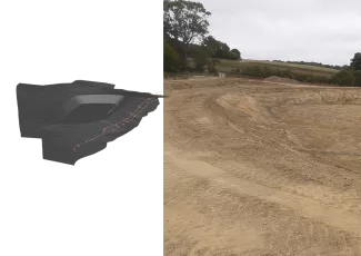
Design, and then setting out a 5000 cu’ metre reservoir shown nearing completion.
Talk to us about your survey requirements today
We cover all of Kent and East Sussex